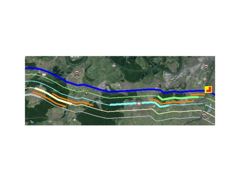
TILOS ProgressMap is a Tilos add on application that enables you to connect the schedule with the locations on earth where the project is executed.
The major functionality is to simulated the construction progress with simplified geometric elements (path’s, symbols and polygons) that represent by its color the progress situation.
The application imports the Google Earth KMZ file (Geometry (path’s, place marks or polygons)).
In the next steps the geometry is connected with TILOS schedule.
Finally an output file as static or dynamic KMZ file is created to visualize the progress in the construction process.
As viewer any GIS program visualizing KMZ data can be used.
View to the earth: TILOS ProgressMap can show your project and schedule on the globe using GIS programs like Google Earth® or ESRI©
The geometry (path, place marks or polygons) can be connected with the schedule data from TILOS.
For each path point a distance value is generated that becomes the connector to the TILOS distance coordinates.

Example: The thick lines displaying work areas of selected crews in week 24-28 April 2013.
The orange lines aside are displaying the baselines (Where the crews should have worked according to the initial plan) The yellow symbol displays that the river drill is progressed by 75 %.

